With tahaki Simple Maps, you empower communities with a clear bird’s eye view to see through a complex social situation, and recognize its moral and civic dimensions, allowing you to launch effective grass-root initiatives and impact millions of lives.
With Tahaki Simple Maps you can:
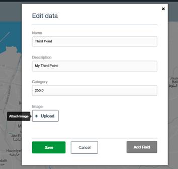
- Create point or area maps from scratch around local and regional topics
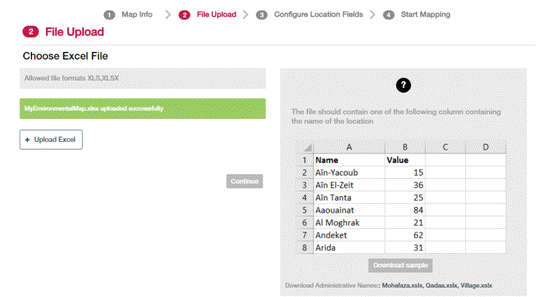
- Create maps from excel data with location coordinates or district names
- Create maps from Twitter, Google, and GIS file formats
- Enrich maps with thematic, bubble and categorical styles
- Create maps with multiple layers and datasets
- Manage maps and data sets through a personalized dashboard
To create simple map start with signing in using your tahaki account.
You can create tahaki Simple Maps from different data sources:
- How can I create a simple map from scratch?
- How can I turn my excel data into simple maps?
- How can I import GPS location to tahaki?
- How can I import ESRI Shapefiles to tahaki?